When we test our octocopters in the wind tunnels of Xi’an, we simulate worst-case scenarios constantly. A lost connection during a critical fire mission is a safety hazard that keeps procurement managers awake at night. safety hazard 1
You must ask specifically about the timeout duration before RTH triggers and whether the drone utilizes obstacle avoidance sensors during the return flight. Crucially, confirm if the system supports dynamic home points and if it can automatically jettison heavy payloads to ensure a safe, battery-efficient return.
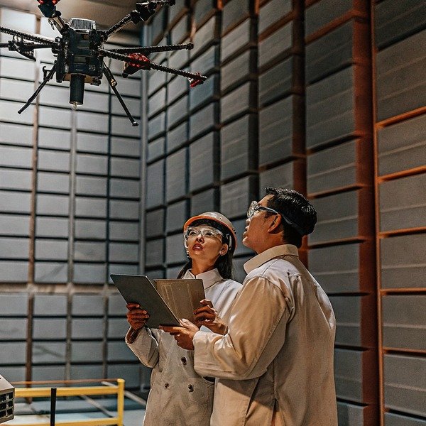
Let’s examine the specific technical questions you need to ask suppliers to ensure your fleet returns safely every time.
How do I verify if the drone avoids obstacles while returning home automatically?
While calibrating our radar systems, we realize that thick smoke often blinds standard optical sensors. thick smoke 2 You cannot afford a drone that blindly follows a GPS line straight into a tree line or building.
Verify that the drone uses a multi-sensor fusion approach, combining LiDAR or millimeter-wave radar with optical cameras. Ask the supplier if the obstacle avoidance system remains active at high return speeds and if it can detect thin objects like power lines in low-visibility, smoke-filled environments.

When you evaluate a firefighting drone, the standard specification sheet often lists "Obstacle Avoidance" as a binary feature—yes or no. However, in our engineering experience, the reality is far more complex. Many consumer-grade or lower-end industrial drones actually disable their obstacle avoidance systems during Return-to-Home (RTH) procedures. They do this to save battery power and increase flight speed. In a firefighting scenario, this "feature" can be disastrous.
The Problem with Straight-Line Returns
A basic RTH protocol draws a straight line from the drone's current location to the home point. It flies this path blindly. If a skyscraper, a dense forest canopy, or a power pylon lies on that line, the drone will impact it. You must ask the supplier if their flight controller supports "Smart RTH" or "Safe RTH." This technology actively scans the environment and alters the flight path to navigate around obstacles rather than flying through them.
Sensor Limitations in Smoke
Firefighting environments present a unique challenge: smoke. Most drones rely on stereoscopic visual cameras for obstacle detection. These cameras work like human eyes; if they cannot see through the smoke, they cannot detect the obstacle. When we design drones for high-temperature environments, we integrate millimeter-wave radar. This technology millimeter-wave radar 3 can penetrate thick smoke and detect solid objects that optical cameras miss. millimeter-wave radar 4
Below is a comparison of sensor technologies you should look for:
| Sensor Type | Visibility in Smoke | Detection Range | Primary Limitation |
|---|---|---|---|
| Visual Cameras | Poor | Short to Medium | Blinded by smoke, darkness, and direct sunlight glare. |
| LiDAR | Moderate | Medium | Can be confused by heavy particulate matter (thick ash or heavy rain). |
| Millimeter-Wave Radar | Excellent | Long | Lower resolution; might miss very thin wires close up. |
| Sensor Fusion | High | Variable | Higher cost and power consumption, but offers the best safety. |
Speed vs. Safety
Another critical question involves speed. Obstacle avoidance processors need time to react. If the drone is returning home at its maximum speed of 15-20 meters per second to escape a fire, the sensors might detect a wall, but the drone may not have the braking distance to stop. You must inquire if the drone automatically governs its speed based on obstacle density. A smart system will slow down when it detects clutter to ensure the avoidance system works effectively.
Can I set a specific return altitude to avoid hitting buildings or trees during signal loss?
We configure our flight controllers to ascend before returning, but fixed heights are risky. In complex urban fires, a default setting might drive your drone straight into the side of a skyscraper.
Yes, you should confirm that the flight control software allows for customizable failsafe altitudes based on the specific mission environment. Ensure the logic commands the drone to vertically ascend to this pre-set safe height immediately upon signal loss before attempting to fly horizontally back to the home point.

The "Failsafe Altitude" is perhaps the single most important setting a pilot inputs before a mission. If this logic is flawed, the drone is almost guaranteed to crash. flight control software 5 When we export units to clients operating in diverse terrains—from the flat plains of the Midwest to the mountainous regions of the Pacific Northwest—we emphasize that this setting must be adjustable in the field, not locked in the factory firmware.
The "Up, Then Over" Logic
The standard industry protocol for RTH is a sequence known as "Up, Then Over."
- Signal Loss: The drone detects a disconnect.
- Ascend: The drone climbs vertically to the pre-set Failsafe Altitude (e.g., 50 meters).
- Return: The drone flies horizontally to the home point.
- Descend: The drone lands.
You need to ask the supplier what happens if the drone is already above that safe altitude. Intelligent logic should dictate that if the drone is at 100 meters and the failsafe is set to 50 meters, it should stay at 100 meters to return. Poorly coded drones will descend to 50 meters, potentially dropping into a fire plume or obstacle field.
Urban vs. Wildland Settings
Different environments require different altitude strategies. In a forest fire, setting the return altitude to 60 meters might clear the tallest trees. However, in an urban environment, 60 meters might be the 20th floor of a building.
Here is a guide on how we recommend clients configure these settings based on the environment:
| Environment | Recommended RTH Altitude Strategy | Risk Factor |
|---|---|---|
| Open Field / Agriculture | 30-50 meters | Low. Main risk is power lines. |
| Dense Forest | 20 meters above tallest tree | Medium. Look out for unexpected snags or hills. |
| Urban / City Center | 100+ meters (Above skyline) | High. Signal interference is common; buildings are tall. |
| Mountainous Terrain | "Return at Current Altitude" | High. Rapid elevation changes make fixed altitudes dangerous. |
Ease of Configuration
Finally, ask the supplier about the user interface. Can the operator change this altitude setting quickly on the ground control station tablet? In an emergency response scenario, fire crews do not have time to connect a laptop and re-flash firmware. The "Return Altitude" parameter should be a prominent, easily editable field on the pre-flight checklist screen.
What questions should I ask about return accuracy when operating in GPS-denied environments?
Our engineers spend months refining algorithms for environments where satellite signals fail. A fire’s massive heat column often distorts or blocks GPS signals, leaving your expensive equipment blind and drifting.
Ask if the drone utilizes an inertial measurement unit (IMU) combined with visual odometry or SLAM technology to maintain position without GPS. Inquire about the expected drift rate per minute during signal loss and whether the system can lock onto visual markers or thermal signatures to land precisely.

Firefighting drones often operate in what we call "GPS-denied" or "GPS-degraded" environments. Heavy smoke contains particulate matter that can scatter signals, and large fires create atmospheric disturbances. GPS signals 6 Furthermore, operating near tall buildings or in deep canyons blocks line-of-sight to satellites. If your drone relies 100% on GPS for RTH, it will simply drift away with the wind when that signal is lost.
Inertial Navigation and Drift
When GPS fails, the drone must switch to ATTI (Attitude) mode or use onboard sensors to guess its position. This is called "Dead Reckoning" using the Inertial Measurement Unit (IMU). Inertial Measurement Unit 7 The problem is drift. Without a satellite fix, a drone might drift 1 to 2 meters per second depending on the wind. Over a 30-second signal loss, your drone could be 60 meters off course.
You must ask the supplier: What is the maximum drift rate in GPS-denied mode? High-end industrial drones use heated IMUs and advanced filtering to keep this drift minimal, allowing the drone to stay relatively stable until the signal is regained.
Visual Positioning Systems (VPS) and SLAM
To combat drift, we integrate Visual Positioning Systems. visual odometry 8 These are downward and forward-facing cameras that track texture on the ground to lock the drone in place. Some advanced systems use SLAM (Simultaneous Localization and Mapping) to build a 3D map of the surroundings in real-time.
- Ask: Does the visual positioning work over water or moving vegetation? (Often it does not).
- Ask: Does it work in low light? (Firefighting often happens at night).
- Ask: Is there a backup compass? (Electromagnetic interference from power lines or equipment can confuse the primary compass).
Landing Accuracy
The final stage of RTH is landing. In a chaotic fire base camp, landing 5 meters off-target could mean landing on a fire truck, a person, or active equipment. Standard GPS is accurate to within 2-3 meters. RTK (Real-Time Kinematic) GPS is accurate Real-Time Kinematic 9 to centimeters, but RTK requires a link to a base station. Real-Time Kinematic 10 If the signal is lost, the RTK correction is also lost.
Therefore, you should ask if the drone has "Precision Landing" capabilities. This technology uses a camera to recognize a specific landing pad pattern (like a QR code or an H) to guide the drone down perfectly, even if the GPS coordinate is slightly off.
How does the drone determine if it has enough battery to return safely when the signal cuts out?
During our load testing, we see how heavy water payloads drain batteries rapidly. A simple percentage check is not enough when carrying ninety gallons of retardant against a strong headwind.
The system must calculate “Smart Return” logic based on real-time distance, wind resistance, and current payload weight, not just remaining voltage. Confirm if the drone automatically triggers a payload drop to extend range and if it calculates the energy required to land safely, not just to reach the home point.

In the consumer drone world, "Low Battery RTH" is usually a simple trigger: when the battery hits 20%, the drone comes home. In industrial firefighting, this logic is dangerously simplistic. A heavy-lift drone carrying fire retardant or emergency supplies consumes power at a much higher rate than an empty drone. If the drone is flying into a 30 mph headwind, it might need 40% battery to return, not 20%.
Dynamic Power Calculation
You need to inquire if the drone's flight computer performs dynamic energy calculations. The software should constantly analyze:
- Distance to Home: How far away is the drone?
- Current Power Consumption: How many Amps are the motors drawing right now?
- Wind Vector: Is the wind helping or hurting the return flight?
If the drone only looks at distance, it will fail. It must look at effort. We call this "Smart Battery RTH." The remote controller should warn the pilot, "Not enough power to return," well before the critical point is reached.
The Payload Factor: Jettison Protocols
This is a feature specific to firefighting and cargo drones. If a drone loses signal and determines it does not have enough battery to return with its full payload, does it have the intelligence to drop the weight?
Imagine a drone carrying a 50kg water hose or a fire extinguishing ball. Dropping that payload might double the remaining flight time.
- Safety Question: Can the drone automatically jettison the payload?
- Liability Question: Where does it drop it? You don't want it dropping a heavy load on people to save the drone.
- Configuration: Can you toggle this feature on or off?
Battery Logic Stages
A robust system should have multiple stages of intervention. It shouldn't just be "Fly" or "Land."
| Alert Level | Battery Status | Drone Action | Operator Override? |
|---|---|---|---|
| Level 1 | "Return Needed" | Visual warning on screen. | Yes |
| Level 2 | "Smart RTH Trigger" | Drone initiates return flight automatically. | Yes |
| Level 3 | "Critical Low Battery" | Drone descends and lands immediately (wherever it is). | No |
| Level 4 | "Voltage Sag" | Emergency motor shutdown (Crash risk). | No |
Ask the supplier specifically about Level 3. If the signal is lost and the battery is critical, will it land in the fire? Or will it try to fly to the nearest safe zone? Understanding this logic is vital for mission planning.
Conclusion
Validating these RTH protocols ensures your investment survives the mission. Safe returns depend on smart logic, robust sensors, and asking the right questions before you buy.
Footnotes
1. Official FAA safety guidelines for commercial unmanned aircraft operations and risk management. ↩︎
2. Official NIST research regarding fire dynamics and sensor performance in smoke-filled environments. ↩︎
3. Technical overview of radar technology used in low visibility. ↩︎
4. Technical research on the effectiveness of millimeter-wave radar for drone obstacle detection in low visibility. ↩︎
5. ISO international standard for unmanned aircraft systems and flight control software requirements. ↩︎
6. Technical explanation of how GPS signals work and factors that cause signal degradation. ↩︎
7. General background on the function and components of an IMU in navigation systems. ↩︎
8. Educational tutorial from University of Zurich on visual odometry for autonomous robot navigation. ↩︎
9. Industry leader explanation of high-precision GNSS positioning. ↩︎
10. Background on RTK technology for enhancing the precision of satellite-based positioning. ↩︎


