When our production team tests drones bound for European markets, signal loss in complex terrain keeps us up at night atmospheric attenuation 1. A crashed sprayer in a French vineyard costs thousands. The problem is real. The stakes are high.
To verify agricultural drone remote control range in complex European environments, conduct systematic field tests using RF signal analyzers, perform incremental distance trials in actual terrain conditions, audit local EMI sources, and request documented range certifications from suppliers that reflect real-world performance rather than ideal laboratory specifications.
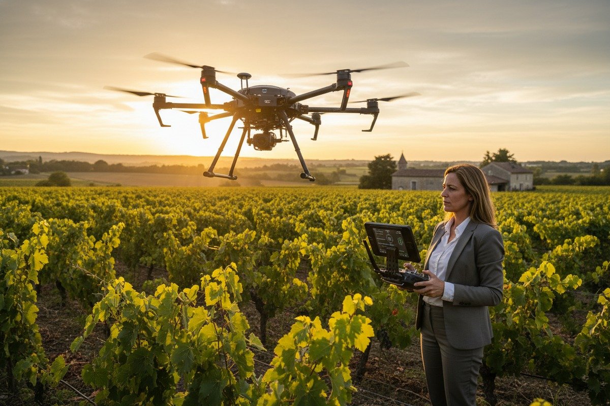
This guide walks you through every step. You will learn practical methods to test signal range, understand European regulations 2, and ensure your investment performs when it matters most. Let us dive in.
How can I conduct a field test to verify the real-world signal range of my agricultural drone?
Our engineers have spent years refining test protocols for clients across France, Germany, and Spain CE marking certificate 3. Many buyers trust manufacturer specs. Then reality hits. Trees block signals. Hills create shadows. Suddenly, a 5 km claim becomes 1.5 km.
Conduct a field test by first performing a stationary ground-range test, then flying incremental distance trials while monitoring RSSI values, packet loss rates, and latency. Use a dedicated RF spectrum analyzer or smartphone RSSI app to log signal strength at each interval until you identify the reliable operational boundary.

Start with a Ground-Range Test
Before takeoff, place your drone at a fixed point. Walk the controller toward your field boundary. Watch signal strength drop. This simple test establishes a baseline without flight risk.
Record readings every 50 meters. Note any sudden drops. These indicate obstacles or interference sources. Our teams always do this before shipping drones to European clients. It saves headaches later.
Incremental Flight Distance Protocol
After ground testing, fly the drone in stages. Start at 100 meters. Move to 200, 300, and continue outward. At each point, hover for 30 seconds. Record these metrics:
| Distance (m) | RSSI (dBm) | Packet Loss (%) | Latency (ms) | Notes |
|---|---|---|---|---|
| 100 | -45 | 0 | 28 | Clear signal |
| 300 | -58 | 0.2 | 35 | Minor fluctuation |
| 500 | -67 | 1.5 | 52 | Approaching VLOS limit |
| 800 | -74 | 4.8 | 89 | Signal degradation |
| 1000 | -82 | 12.3 | 145 | Unstable link |
Stop when packet loss exceeds 5% or latency climbs above 100 ms. This marks your practical range limit.
Tools for Signal Monitoring
Budget options include smartphone apps that log RSSI from your controller's WiFi. Professional options include handheld RF spectrum analyzers. When we calibrate flight controllers at our facility, we use analyzers with 80 MHz bandwidth. This captures the full frequency hopping pattern.
For most farmers and distributors, a mid-range analyzer costing €500-€1,500 works well. It shows real-time signal strength and identifies interference sources.
Document Everything
Create a test report. Include date, weather conditions, terrain type, and all recorded metrics. This document proves your verification process. European regulators may request it for BVLOS applications.
How do I assess the impact of European terrain and obstacles on my drone's control distance?
In our experience exporting to vineyard operators and orchard managers across Europe, terrain causes more signal problems than equipment failures. Rolling hills in Tuscany, dense hedgerows in England, and forested valleys in Bavaria each present unique challenges.
Assess terrain impact by mapping your operational area for obstacles, calculating Fresnel Zone clearance based on crop height, and testing in representative conditions including humidity levels. European terrain typically reduces advertised range by 50-80% due to multipath interference, signal shadowing, and atmospheric attenuation.

Understanding Signal Propagation
Radio waves travel in straight lines. But they also spread outward in an elliptical pattern called the Fresnel Zone 4. Any object entering this zone—a tree, a barn, a hill—weakens the signal.
For a drone flying at 30 meters altitude over 500 meters distance, the Fresnel Zone 5 bulges about 3 meters at its widest point. Tall maize or vineyard trellises can penetrate this zone and degrade your link.
Common European Terrain Challenges
| Terrain Type | Signal Impact | Typical Range Reduction | Mitigation Strategy |
|---|---|---|---|
| Rolling hills | Creates signal shadows | 40-60% | Fly higher, use relay stations |
| Dense forests | Heavy attenuation | 60-80% | Use 2.4 GHz, avoid canopy flyover |
| Orchards | Moderate multipath | 30-50% | Maintain altitude above tree line |
| Urban-rural fringe | EMI interference | 20-40% | Map interference sources, choose clear bands |
| Coastal areas | Humidity + refraction | 30-50% | Account for temperature inversions |
Map Your EMI Sources
European agricultural landscapes have hidden signal threats. High-voltage power lines run across fields. Rural telecommunications towers dot the countryside. Military installations create frequency blind spots.
Before flying, identify these sources on a map. Draw a 500-meter buffer around each. Plan flight paths to avoid them. Our clients in Germany have lost control links near military zones with no warning. Mapping prevents surprises.
Calculate Fresnel Zone Clearance
Use this formula: Fresnel radius = 17.3 × √(distance in km / frequency in GHz)
For 2.4 GHz at 500 meters:
Radius = 17.3 × √(0.5 / 2.4) = 7.9 meters at the midpoint
Your drone and controller must both clear obstacles by this margin. If crops grow to 3 meters and your drone flies at 8 meters, the midpoint clearance is only 5 meters—below the required 7.9 meters. Fly higher or operate shorter distances.
Weather Considerations
European maritime climates bring humidity. Moisture in the air absorbs radio waves, especially at 5.8 GHz. Dense fog reduces range by 20-30% compared to clear days.
Temperature inversions in mountainous and coastal regions cause multipath interference 6. The signal bounces off atmospheric layers and arrives at the receiver multiple times, slightly delayed. This creates control instability.
Test on representative weather days. A clear morning test does not predict foggy afternoon performance.
What can I do to ensure my drone's remote link stays stable in high-interference environments?
When we test our hexacopters before shipping to European distributors, interference simulation is standard practice. Clean lab conditions never match field reality. A stable link saves your investment and your crop.
Ensure link stability by selecting appropriate frequency bands for your environment, deploying directional high-gain antennas, implementing 4G/5G backup links, and enabling automatic Return-to-Home features. Monitor RSSI continuously during operation and establish conservative operational boundaries at 70% of tested maximum range.

Choose the Right Frequency Band
Different frequencies have different strengths:
| Frequency | Penetration | Range (Ideal) | Best Use Case | Interference Risk |
|---|---|---|---|---|
| 433 MHz | Excellent | 5+ km | Open fields, BVLOS | Low |
| 900 MHz | Very good | 3-5 km | Mixed terrain | Low |
| 2.4 GHz | Good | 2-3 km | Obstacle-heavy areas | Medium |
| 5.8 GHz | Poor | 1-2 km | High-EMI, clear LOS | High |
For hedgerows and farm buildings, 2.4 GHz penetrates better. For high-interference areas with clear sightlines, 5.8 GHz avoids crowded spectrum. Our agricultural sprayers ship with dual-band controllers. Operators switch based on conditions.
Upgrade Your Antennas
Stock antennas are omnidirectional. They broadcast equally in all directions. This wastes power.
Directional antennas focus energy toward the drone. A parabolic reflector can add 6-10 dB gain. This effectively doubles or triples your range in that direction. For valley operations, point the antenna into the depression.
Ground station antenna upgrades cost €100-€400. The return on investment is immediate.
Implement Backup Links
Modern agricultural drones support 4G/5G data links as backups. When the primary RC signal weakens, cellular takes over. This adds redundancy.
However, cellular adds latency. Expect 80-200 ms versus 30-50 ms for direct RC links. Also, rural European 4G coverage has gaps. Verify local coverage before relying on this backup.
RTK correction 7 data often travels over cellular NTRIP connections. If the RTK link drops, precision spraying degrades even if control remains stable. Test both links together.
Configure Return-to-Home
Every professional agricultural drone should have RTH configured:
- Signal loss RTH: Activates after 3-5 seconds of link loss
- Low battery RTH: Triggers at 20-25% remaining capacity
- Geofence RTH: Prevents flyaway beyond preset boundaries
Set your RTH altitude above the tallest obstacle plus 10 meters. A drone returning home at 15 meters will crash into a 20-meter tree line.
Continuous Monitoring During Flight
Do not fly blind. Display RSSI on your controller or ground station monitor. Many systems show a percentage or bar graph. Learn what values mean trouble.
General guidelines:
- Above -60 dBm: Strong signal
- -60 to -70 dBm: Good signal
- -70 to -80 dBm: Marginal, reduce distance
- Below -80 dBm: Poor, return immediately
Set audible alarms for threshold breaches. Our ground control stations ship with configurable alerts.
What documentation should I request from my supplier to confirm their drone's range in complex environments?
Our sales team fields this question weekly. Smart procurement managers want proof, not promises. The right documentation separates reliable suppliers from salespeople. Ask for these items before signing any purchase order.
Request field test reports showing actual range measurements in terrain similar to your operational environment, RF certification documents for European CE marking, EASA compliance documentation for your intended operation category, and references from existing European customers who can verify real-world performance claims.

Essential Technical Documentation
| Document Type | What It Proves | Red Flag If Missing |
|---|---|---|
| RF test report | Actual signal performance data | Supplier relies only on lab specs |
| CE marking 8 certificate | European radio frequency compliance | Cannot legally sell in EU |
| EASA type certificate | Meets drone safety standards | May not be approved for commercial use |
| User manual with range specs | Official performance claims | No written commitment |
| Warranty terms | Coverage for signal-related failures | Supplier avoids accountability |
Ask for Field Test Reports
Demand test reports from environments matching yours. Vineyards differ from grain fields. Alpine valleys differ from Dutch flatlands.
A credible supplier provides:
- Test location description
- Weather conditions during test
- Equipment used for measurement
- Incremental distance data with RSSI values
- Packet loss percentages at maximum range
- Photos or videos of test conditions
If a supplier cannot provide this, they have not tested properly. At our facility, we generate these reports for every model before export.
Verify Regulatory Compliance
For European operations, check these approvals:
CE Marking: Required for radio equipment sold in the EU. Ask for the Declaration of Conformity listing applicable directives.
EASA Classification: Open Category (A1, A2, A3), Specific Category, or Certified Category. Your operational needs dictate which class you need. Agricultural spraying typically requires Specific Category authorization.
Remote ID Compliance: New regulations require drones to broadcast identification data. Ask if the drone supports Remote ID. Test it yourself by scanning via smartphone WiFi.
Request Customer References
Ask for contact details of existing European customers. Call them. Ask these questions:
- Does the drone achieve advertised range in your terrain?
- Have you experienced unexpected signal loss?
- How responsive is the supplier to technical problems?
- Would you purchase from them again?
Honest suppliers provide references willingly. Evasive responses signal trouble.
Review Warranty Terms Carefully
Check what the warranty covers regarding signal and control systems:
- Are RF components covered?
- What is the process for control-related failures?
- Does the warranty require using approved antennas only?
- What happens if signal loss causes a crash?
Get answers in writing. Verbal promises disappear when problems arise.
Independent Testing Options
For high-value purchases, consider third-party verification. The agrifoodTEF initiative offers field validation services for UAV systems in agricultural environments. They test under real European conditions and provide independent certification.
Cost is significant—several thousand euros—but worthwhile for fleet purchases or government contracts. For single-unit buyers, supplier documentation combined with your own field tests suffices.
Conclusion
Verifying agricultural drone range in complex European environments requires systematic field testing, terrain assessment, link stability measures, and proper supplier documentation. Take control of your verification process. Your crops, your equipment, and your business depend on it.
Footnotes
1. Details how atmospheric conditions affect the propagation of radio waves. ↩︎
2. Official EASA portal for EU drone laws ↩︎
3. Official European Commission page on the Radio Equipment Directive and CE marking. ↩︎
4. Authoritative scientific definition of signal propagation physics ↩︎
5. Provides a comprehensive explanation of the Fresnel Zone in radio propagation. ↩︎
6. Explains the phenomenon of multipath propagation and its effects on signals. ↩︎
7. Technical definition from the European Space Agency ↩︎
8. Official European Commission page on CE standards ↩︎


