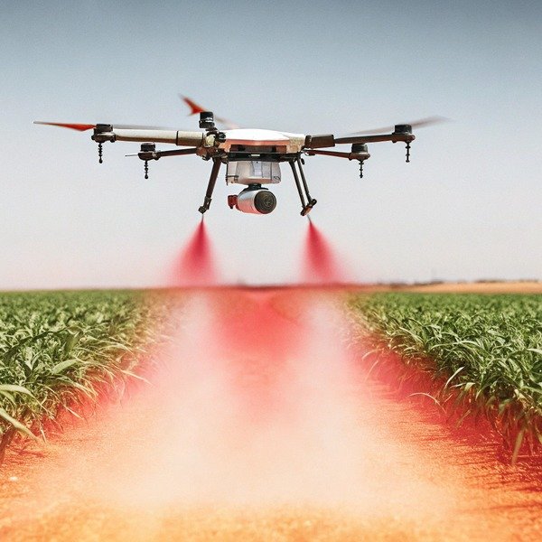
We frequently hear from clients who struggle with gaps in their spray patterns, only to realize their positioning systems are drifting. When we test units at our Xi’an facility, we know that verifying precision is the only way to guarantee profitability in the field.
To determine if your agricultural drone meets RTK standards, verify that the control software displays a “Fixed” status and compare reported coordinates against surveyed Ground Control Points (GCPs). Ensure the system consistently achieves 1–2 cm horizontal and 2–4 cm vertical accuracy during stable flight conditions.
Below, we outline the exact validation protocols and technical parameters we use to ensure our systems deliver professional-grade results.
What specific field tests can I perform to verify the precision of my drone's RTK system?
Trusting spec sheets blindly often causes major operational headaches. We advise our distributors to run specific validation protocols immediately after unboxing to ensure the hardware sensors survived transit perfectly.
Perform a Ground Control Point (GCP) comparison by hovering over surveyed markers and calculating the root mean square error. Additionally, conduct a pass-to-pass repeatability test by flying the same route multiple times to ensure deviation remains under 2.5 cm for consistent crop coverage.

Establishing a Ground Control Point (GCP) Baseline
The most definitive way to test accuracy is to compare what the drone "thinks" its location is against a known reality. In our testing grounds, we do not rely on the drone's internal map alone. We set up physical targets on the ground. physical targets on the ground 1 You can replicate this by hiring a professional surveyor to mark a specific point on your farm with a high-precision GPS stick, or by using a permanent physical landmark with known coordinates.
Once you have this "truth" point, fly the drone to hover exactly above it. Record the coordinates displayed on your flight controller. Do this multiple times. You should land the drone, reboot it, take off, and hover over the point again. If the drone reports the exact same coordinate (within a centimeter or two) every time, your initialization is consistent. If the reported coordinates shift by 10 or 20 centimeters between flights while the physical drone is in the same spot, the system is failing the repeatability standard.
The Static Drift Test
Another simple yet effective test we recommend involves leaving the drone stationary on the ground. Power on the drone and the RTK base station. Ensure they have a solid link. Do not arm the motors. Instead, start logging the position data for 30 to 60 minutes.
In a perfect system, the position should not move. However, in the real world, you will see a "cloud" of points. The tighter this cloud, the better the accuracy. If you see the reported position "walking" or drifting several meters over an hour, it indicates that the system is struggling to resolve atmospheric errors 2 atmospheric errors or that the base station itself is not positioned correctly.
Pass-to-Pass Repeatability
For agricultural spraying, absolute global accuracy is often less important than relative accuracy. This means the drone needs to know where it is relative to its last pass. To test this, program a simple automatic route with parallel lines. Coat the drone's landing gear in chalk or use a camera payload.
Run the mission. Then, without changing the mission plan, run it again. The drone should follow the exact same invisible tracks in the sky. If you are spraying liquid, the wet lines on the crop should overlap exactly as calculated. If you see wide gaps between the first mission's lines and the second mission's lines, your pass-to-pass accuracy is degrading, which will ruin variable Variable Rate Application 3-rate application plans.
Testing Protocol Summary
We use the following checklist to grade our export units. You can use this to grade your own equipment.
| Test Name | Procedure | Critères de réussite |
|---|---|---|
| Hover Check | Hover over a known GCP for 60 seconds. | Horizontal deviation < 2 cm; Vertical deviation < 3 cm. |
| Re-initialization | Land, power cycle, and return to the exact physical spot. | Coordinate variance < 2.5 cm from previous flight. |
| Static Drift | Record position for 30 mins while stationary. | Position drift < 1.5 cm over the duration. |
| Return-to-Home | Trigger RTH from 500m away. | Landing within 5-10 cm of the takeoff point. |
Which technical parameters should I check to ensure the positioning meets industry standards?
While engineering our flight controllers, we monitor data streams that most end-users ignore. However, ignoring these specific values often leads to poor field performance and frustrating downtime during the busy season.
Check that your horizontal precision remains within 1–2 cm and vertical precision within 2–4 cm. Monitor the satellite count to ensure at least 15–20 satellites are locked with high Signal-to-Noise Ratios, and confirm the system maintains a low latency data link with the base station.

Understanding RTK Status Modes
The most immediate parameter to check on your flight dashboard is the RTK solution status. RTK solution status 4 This is usually a simple indicator, but it tells a complex story. You will typically see one of three states: "Single," "Float," or "Fixed."
- Single: The drone is using standard GPS. Accuracy is around 1 to 2 meters. This is unacceptable for precision spraying.
- Float: The drone is receiving corrections from the base station, but it hasn't mathematically resolved the carrier phase ambiguities. Accuracy is floating between 20 cm and 1 meter. You cannot spray accurately in this mode.
- Fixed: The system has "locked" onto the satellites and the corrections. Accuracy is now at the centimeter level (1–3 cm).
If your system struggles to hold a "Fixed" status and constantly drops to "Float," the hardware may be failing to meet industry standards for receiver sensitivity.
Horizontal vs. Vertical Precision (H-RMS vs. V-RMS)
In our technical specs, you will see accuracy listed as "H" (Horizontal) and "V" (Vertical). It is crucial to understand that vertical accuracy is naturally weaker than horizontal accuracy due to the geometry of satellites 5 geometry of satellites; they are all above the drone, none are below it.
For a standard agricultural drone, a horizontal accuracy (H-RMS) of 1 cm + 1 ppm is standard. Vertical accuracy (V-RMS) is typically double that, around 2 cm + 1 ppm. If you check your logs and see vertical jumps of 10 cm or more, this is a red flag. While horizontal shifts cause gaps in spraying, vertical shifts are dangerous because they can cause the drone to crash into the crop canopy or fly too high, causing spray drift.
Age of Differential Data
This is a hidden parameter that is vital for stability. It measures how "old" the correction data from the base station is. Ideally, this number should be close to 1 second. If the "Age of Differential" spikes to 5 or 10 seconds, it means the radio link between your drone and the base station is weak.
High latency means the drone is making decisions based on where the satellites were seconds ago, not where they are now. When we troubleshoot for clients in the US, high latency is often the culprit behind "wobbly" flight behavior.
Critical Parameter Thresholds
When evaluating your system logs, compare your data against these benchmarks.
| Parameter | Standard | Warning Zone | Critical Failure |
|---|---|---|---|
| Satellite Count | 20+ Satellites | 12-19 Satellites | < 12 Satellites |
| PDOP (Dilution of Precision) | < 1.5 | 1.5 – 2.5 | > 2.5 |
| Link Latency | < 1 second | 1 – 3 seconds | > 3 seconds |
| Signal-to-Noise (SNR) | > 40 dBHz | 35 – 40 dBHz | < 35 dBHz |
How do I troubleshoot common environmental factors that degrade the accuracy of my agricultural drone?
Even our most durable drones can struggle in bad environments. When we support US clients remotely, we usually find the surroundings, rather than the drone hardware, are the culprit behind accuracy issues.
Identify multipath interference caused by tall structures or trees blocking signals and relocate the base station to an open area with a clear sky view. Monitor atmospheric conditions, as ionospheric activity can disrupt signals, and ensure the telemetry link frequency is free from local radio interference.

Multipath Interference Explained
One of the most common issues we diagnose is multipath interference 6 multipath interference. This happens when the satellite signal bounces off a surface—like a metal barn, a silo, a parked truck, or even a dense tree line—before hitting the drone's antenna.
Because the signal took a longer path to get to the antenna, the timing is slightly off. Since GPS relies entirely on timing to calculate distance, this "echo" confuses the receiver. If you are testing your drone's accuracy inside a courtyard or near a large metal warehouse, the results will be poor. Always move your testing to the center of the field, far away from vertical structures. We recommend a clearance angle of at least 15 degrees above the horizon for the base station.
Base Station Placement Errors
The accuracy of the drone is only as good as the placement of the base station. A common mistake we see is placing the tripod on unstable ground, such as mud or loose gravel. If the tripod sinks even a few millimeters during the operation, that shift is transmitted to the drone as a movement.
Additionally, the base station needs a perfect view of the sky. If you set it up under the edge of a tree canopy to keep it in the shade, you are blocking a significant portion of the sky. This reduces the number of common satellites that both the drone and the base station can see. For the math to work, both units need to see the same satellites at the same time.
Electromagnetic and Radio Interference
Agricultural environments are noisier than they appear. High-voltage power lines are a known source of interference for the drone's compass and GNSS receiver. If your field has power lines running through it, accuracy will likely degrade as you fly closer to the wires.
Furthermore, verify your radio frequency. If you are using a radio link (like 900MHz or 433MHz) for your RTK corrections, ensure no other farm equipment is broadcasting on that same channel. We have seen instances where automated irrigation systems communicating on similar frequencies caused intermittent packet loss for the drone, leading to the "Age of Differential" spiking and accuracy dropping.
Environmental Troubleshooting Guide
Use this table to identify the likely external cause of your accuracy problems.
| Symptôme | Probable Environmental Cause | Solution |
|---|---|---|
| Drifting Position near Buildings | Multipath multipath interference 7 Interference | Move takeoff point 50m away from structures. |
| Loss of "Fixed" Status in Flight | Tree Canopy Blocking Signal | Increase flight altitude or trim operational boundaries. |
| Sudden Compass Errors | Magnetic Interference | Avoid flying within 30m of high-voltage lines. |
| High Latency / Lag | Radio Frequency Congestion | Change telemetry channel or switch to NTRIP (Internet) corrections. |
Why is centimeter-level RTK accuracy critical for the success of my precision farming operations?
Precision isn't just a buzzword we use in marketing materials. When we design spray nozzles and flow control systems, we know that even slight deviations ruin the efficacy of variable-rate applications.
Centimeter-level accuracy eliminates spray overlap and gaps, ensuring chemicals are applied exactly where needed to reduce costs and environmental impact. It enables precise automated flight paths for repeatable crop monitoring and allows for accurate field boundary mapping, which is essential for billing and compliance.

The Economics of Overlap and Gaps
The primary reason our clients invest in RTK-equipped drones is cost reduction. Without RTK, a drone relies on standard GPS, which has an accuracy of roughly 1-2 meters. If you are spraying a field with a 5-meter spray width, a 1-meter error is a 20% deviation.
To ensure no crop is missed (gaps), an operator without RTK must program a high overlap percentage, often 30-40%. This means you are spraying 30% more chemical than necessary. With RTK accuracy (2 cm), we can reduce the safety overlap to less than 10% or just enough to account for wind. Over thousands of acres, this reduction in chemical usage pays for the drone itself. Conversely, if you rely on standard GPS and don't overlap, you will leave strips of unsprayed crops where pests or disease can thrive, ruining the yield.
Enabling Advanced Variable Rate Applications
Modern agriculture is moving away from "blanket spraying" toward Variable Rate Application (VRA). This involves scanning a field with a multispectral camera to identify sick plants and then sending a spray drone to treat only those specific spots. multispectral camera 8
This workflow is impossible without centimeter-level accuracy. If the map says a weed patch is at a specific coordinate, but your spray drone is off by a meter, you will spray healthy crops and miss the weeds entirely. Our systems are designed to synchronize the map and the sprayer perfectly. This "spot spraying" capability is the future of sustainable farming, drastically reducing the volume of pesticides released into the environment. sustainable farming 9
Repeatable Data for Crop Analysis
For agronomists, the value lies in data consistency. To track crop growth over a season, you need to photograph the exact same plants week after week. If your flight path shifts by a meter every time you fly, the software cannot accurately overlay the images to show growth trends.
RTK ensures that the drone flies the exact same "rails" in the sky every week. This repeatability allows software to detect minute changes in plant height or chlorophyll content. This data-driven approach allows farmers to intervene early with water or fertilizer, maximizing yield potential before it is too late.
Conclusion
Validating your RTK system ensures efficiency and prevents costly application errors. Regular testing of field accuracy, monitoring technical parameters, and managing environmental factors protects your investment and guarantees the high-level performance required for modern precision agriculture 10 precision agriculture.
Notes de bas de page
1. ISO standard for field procedures for testing geodetic and surveying instruments like GNSS. ︎
2. NOAA authority on atmospheric impacts on GPS. ︎
3. University extension resource on VRA technology. ︎
4. Explains the fundamental technology behind Real-Time Kinematic positioning for general background. ︎
5. ESA Navipedia explains satellite geometry (DOP) effects. ︎
6. Official government explanation of GPS error sources. ︎
7. Background on the physics of signal reflection and its impact on wireless communication and positioning. ︎
8. Product documentation for multispectral hardware used for crop health mapping in precision agriculture. ︎
9. Recent reporting on how technology and precision tools are driving the transition to sustainable farming. ︎
10. USDA NIFA overview of precision agriculture technologies. ︎


