When our engineering team first tested LiDAR systems 1 for firefighting drones, we discovered that manufacturer specifications rarely matched real-world performance. Many procurement teams face the same frustration—investing heavily in drones only to find ranging errors compromise critical fire operations.
To verify LiDAR ranging accuracy, conduct field tests using at least 30 ground control points, request technical certifications like ASPRS compliance, test performance in smoke and heat conditions, and demand live demonstrations from suppliers. Cross-validate data with total stations and GPS to confirm claimed specifications.
This guide walks you through practical verification methods we have refined through years of manufacturing and exporting firefighting drones ISO 9001 quality management certification 2. Let us dive into each critical aspect of LiDAR accuracy verification.
How can I conduct a field test to verify the LiDAR precision on my firefighting drones?
Our production floor has seen countless LiDAR units come through testing. The gap between datasheet claims and actual performance can reach 200-300% in some cases. This reality makes field testing non-negotiable before any procurement decision.
Conduct field tests by setting up minimum 30 evenly distributed ground control points on flat, non-vegetated surfaces. Fly the drone at operational altitudes and speeds, then compare collected data against known reference points using survey-grade GPS or total stations to calculate RMSE values.

Setting Up Your Test Environment
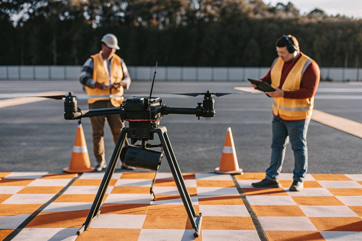
Choose a test site that represents your operational conditions. For firefighting applications, this means varied terrain with some slopes, vegetation edges, and open areas. Avoid testing only on perfect surfaces—real fires do not happen on parking lots.
Mark your ground control points 3 with high-visibility targets. These targets should be clearly visible from flight altitude and large enough for the LiDAR to capture cleanly. Many teams use 0.5-meter square reflective panels.
Flight Parameters for Accurate Testing
Your test flights should mirror actual mission profiles. If your firefighting drones typically fly at 80 meters altitude at 8 m/s, test at those exact parameters. Speed and altitude directly affect point density and accuracy.
Run multiple flight passes with varying overlap percentages. Standard practice involves 60-70% side overlap and 80% forward overlap. Higher overlap improves point cloud consistency and reveals sensor alignment issues.
Data Collection and Analysis Protocol
| Test Parameter | Recommended Value | Warum es wichtig ist |
|---|---|---|
| Ground Control Points | Minimum 30 | ASPRS standard for robust assessment |
| Point Distribution | Even across test area | Prevents localized bias hiding overall errors |
| Surface Slope | <10 degrees for checkpoints | Reduces measurement complexity |
| Flight Altitude | Operational height | Matches real-world conditions |
| Overlap Percentage | 60-70% side, 80% forward | Ensures consistent point density |
Use software tools like CloudCompare or LP360 to process point clouds. Calculate Root Mean Square Error 4 for both horizontal and vertical dimensions. For firefighting applications, you need horizontal accuracy of ±1-5 cm and vertical accuracy of ±1-3 cm when using RTK positioning.
Interpreting Your Results
Compare your calculated RMSE against the manufacturer's stated specifications. If the datasheet claims 2 cm vertical accuracy but your tests show 6 cm, you have grounds for negotiation or rejection.
Document everything with timestamps, environmental conditions, and equipment serial numbers. This documentation protects you during warranty claims and provides baseline data for future recalibration needs.
What technical certifications should I request from my supplier to guarantee LiDAR ranging accuracy?
When we prepare export documentation for clients in the United States and Europe, certification requirements form the backbone of technical compliance. Without proper certifications, you cannot verify that a LiDAR system meets industry standards or regulatory requirements.
Request ASPRS-compliant accuracy reports, ISO 9001 quality management certification, CE marking for European markets, FCC compliance for US operations, and independent third-party test reports. Additionally, demand sensor-specific calibration certificates with traceable measurement standards.

Essential Certifications for LiDAR Systems
Not all certifications carry equal weight. Some indicate manufacturing quality, others confirm technical performance, and some ensure regulatory compliance. You need all three categories covered.
ASPRS (American Society for Photogrammetry and Remote Sensing) guidelines represent the gold standard for accuracy specifications. ASPRS guidelines 5 Edition 2 of their standards introduced stricter requirements including RMSEH calculations and doubled precision needs for ground control points.
Certification Categories Explained
| Art der Zertifizierung | Was wird abgedeckt? | Warum Sie es brauchen |
|---|---|---|
| ASPRS Accuracy Report | Horizontal/vertical precision validated | Industry-standard accuracy verification |
| ISO 9001 | Manufacturing quality management | Consistent production standards |
| CE-Kennzeichnung 6 | European safety compliance | Erforderlich für den EU-Marktzugang |
| FCC Part 15/107 | Einhaltung der US-Funkfrequenzvorschriften | Legal operation in United States |
| Calibration Certificate | Sensor-specific alignment data | Traceable accuracy baseline |
| Independent Test Report | Third-party performance validation | Unbiased accuracy confirmation |
Red Flags in Certification Documentation
Watch for certificates that lack specific measurement data. A valid accuracy certification includes test dates, equipment used, environmental conditions, sample sizes, and calculated statistics. Generic statements like "meets industry standards" without supporting data mean nothing.
Check certificate validity dates. Calibration certificates typically expire after 12-24 months. An expired certificate suggests the supplier has not maintained proper quality control.
Verify the certifying body's legitimacy. Some manufacturers cite internal testing as "certification." True third-party certification comes from accredited laboratories with no financial relationship to the supplier.
Certification Requirements by Market
Your target market determines minimum certification requirements. For US government contracts, you may need additional documentation beyond commercial standards. European tenders often require specific CE marking categories.
Our experience exporting to multiple regions has shown that over-documentation beats under-documentation. Request copies of all certifications before purchase, and verify their authenticity directly with issuing organizations when possible.
Building Your Certification Checklist
Create a master checklist before contacting suppliers. Include mandatory certifications for your market, preferred third-party validators, and minimum acceptable test parameters. This checklist standardizes your evaluation process and prevents suppliers from overwhelming you with irrelevant documentation.
Will the LiDAR ranging accuracy on my drones remain stable in high-smoke and high-heat environments?
Our R&D team has spent considerable time testing LiDAR performance under adverse conditions. The 2025 California wildfire season provided harsh lessons about environmental impacts on drone sensor systems. Heat shimmer 7 and dense smoke can transform a precise instrument into an unreliable one.
LiDAR accuracy degrades in high-smoke and high-heat environments, but modern sensor fusion systems combining LiDAR with radar and thermal cameras maintain 2-3 cm accuracy through adaptive filtering algorithms. Request environmental stress test data and verify multi-sensor redundancy before procurement.

How Smoke Affects LiDAR Performance
Smoke particles scatter laser pulses before they reach the ground surface. Dense smoke can completely block signal return, creating data voids in your point cloud. Even moderate smoke reduces effective range and introduces noise into measurements.
The severity depends on smoke density and particle composition. Wildfire smoke differs from structural fire smoke in composition and optical properties. Testing with one type does not guarantee performance with another.
Thermal Effects on Sensor Accuracy
Heat creates multiple problems for LiDAR systems. High temperatures affect electronic components, potentially causing drift in timing circuits that directly impacts ranging calculations. Thermal expansion can shift optical alignments calibrated at room temperature.
Heat shimmer—visible distortion from hot air rising—bends laser beams unpredictably. This effect worsens near active flames and hot surfaces. Measurements taken through shimmer zones show increased error rates.
Environmental Performance Specifications
| Umweltfaktor | Impact on Accuracy | Strategie zur Risikominderung |
|---|---|---|
| Light Smoke | 10-20% range reduction | Increased pulse power |
| Dense Smoke | Up to 80% signal loss | Multi-sensor fusion |
| Ambient Heat (>40°C) | 5-15% accuracy degradation | Active cooling systems |
| Heat Shimmer | Variable, unpredictable | Thermal camera cross-validation |
| Rain/Fog | Moderate signal scattering | Weather-adaptive algorithms |
Multi-Sensor Fusion Solutions
Modern firefighting drones address environmental challenges through sensor redundancy. Combining LiDAR with radar provides ranging capability when smoke blocks optical wavelengths. Thermal cameras detect hot spots even when visible smoke obscures the LiDAR view.
When we design systems for harsh environments, we build in adaptive filtering algorithms that automatically weight data from multiple sensors based on real-time quality assessments. If LiDAR confidence drops, the system shifts reliance to radar or thermal data.
Testing for Environmental Resilience
Demand environmental stress testing data from your supplier. This testing should include controlled smoke exposure at various densities, operation at elevated temperatures, and combined stress conditions.
Ask specifically about LIOR (LiDAR-Inertial Odometry and Mapping) or DDIOR (Deep Learning-enhanced) algorithms that compensate for environmental interference. These advanced processing methods can recover accurate ranging data from degraded signals.
Long-Term Stability Considerations
Environmental exposure accelerates sensor degradation. Each mission through smoke and heat contributes to cumulative wear on optical components and electronic systems. Establish recalibration schedules based on operational intensity rather than calendar time alone.
Our manufacturing data shows that firefighting drones require recalibration 2-3 times more frequently than survey drones operating in benign conditions. Factor these maintenance costs into your total ownership calculations.
Can I collaborate with my manufacturer to customize and calibrate LiDAR sensors for specific firefighting scenarios?
Our engineering team regularly works with clients to develop specialized configurations for unique operational requirements. Standard off-the-shelf systems rarely optimize performance for specific firefighting applications. Custom calibration and sensor tuning can dramatically improve results.
Yes, reputable manufacturers offer customization services including scenario-specific calibration, modified filtering algorithms, integration with existing equipment, and specialized mounting configurations. Establish clear performance specifications, testing protocols, and acceptance criteria before beginning collaborative development.

Types of Customization Available
Customization ranges from simple parameter adjustments to complete system redesigns. Understanding your options helps you specify exactly what you need without overpaying for unnecessary modifications.
Calibration customization adjusts sensor parameters for your specific operating envelope. If you primarily fight forest fires at high altitude, calibration optimized for those conditions outperforms generic settings designed for average conditions.
Common Customization Options
| Customization Type | What It Involves | Typical Lead Time |
|---|---|---|
| Calibration Tuning | Parameter optimization for specific conditions | 1-2 Wochen |
| Algorithm Modification | Custom filtering for environmental factors | 4-8 Wochen |
| Hardware Integration | Mounting, wiring for existing platforms | 2-4 Wochen |
| Software Development | Custom interfaces, data outputs | 8-12 weeks |
| Complete System Design | Ground-up development for unique requirements | 3-6 Monate |
Establishing Collaboration Framework
Successful customization projects require clear documentation from the start. Define your performance requirements in measurable terms—not "better accuracy" but "±2 cm vertical accuracy at 100m altitude in moderate smoke."
Create acceptance testing protocols before development begins. Both parties must agree on how success will be measured. Ambiguous criteria lead to disputes when the project concludes.
Schutz Ihrer Investition
Intellectual property considerations 9 matter when developing custom solutions. Determine upfront who owns modifications, whether the manufacturer can offer similar customizations to competitors, and what documentation you will receive.
Request full calibration data and algorithm parameters, not just a calibrated unit. This documentation allows you to verify calibration independently and provides baseline information for future recalibration.
Working Through Development Challenges
Custom development rarely proceeds without obstacles. Build flexibility into your timeline and budget for iterations. The first calibration attempt may reveal issues requiring additional refinement cycles.
Maintain regular communication throughout development. Weekly progress updates catch problems early when corrections are inexpensive. Discovering issues at final acceptance creates costly delays and contentious negotiations.
Evaluating Manufacturer Capabilities
Not all manufacturers can support custom development equally. Evaluate their engineering team depth, previous customization projects, and willingness to share development resources before committing.
Our facility in Xi'an maintains dedicated engineering support for custom projects because we understand that firefighting applications demand specialized solutions. Ask potential suppliers about their engineering team size and relevant experience.
Post-Delivery Support Considerations
Customization extends your relationship with the manufacturer beyond initial purchase. Custom systems require ongoing support from engineers who understand the modifications. Verify that support agreements cover your specific configuration, not just standard products.
Plan for recalibration needs specific to your custom setup. Standard service centers may lack capability to work on modified systems. Ensure your manufacturer provides recalibration services or thoroughly documents procedures for third-party service.
Schlussfolgerung
Verifying LiDAR ranging accuracy protects your investment and ensures mission success. Follow structured field testing protocols, demand proper certifications, verify environmental performance, and explore customization options with capable manufacturers to procure firefighting drones that perform reliably when lives depend on precision.
Fußnoten
1. Explains what LiDAR technology is and its applications. ︎
2. Official information on ISO 9001 quality management system standards. ︎
3. Found an authoritative and relevant page on USGS.gov explaining ground control points. ︎
4. Explains the statistical concept of Root Mean Square Error. ︎
5. Provides official ASPRS accuracy standards for geospatial data. ︎
6. Official explanation of CE marking requirements for products in the EU. ︎
7. Describes the atmospheric optical phenomenon known as heat shimmer or heat haze. ︎
8. Explains the concept and applications of sensor fusion technology. ︎
9. Discusses intellectual property in the context of innovation and development. ︎


