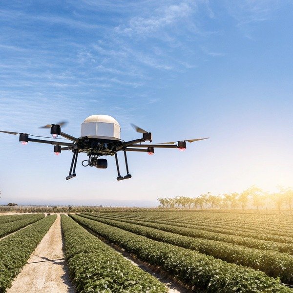
We often see farmers struggle with inefficient single-drone setups that leave vast fields untreated. Time is money, and relying on outdated, disjointed workflows can destroy your seasonal profit margins.
To inquire about multi-drone coordination, ask vendors about “One-to-Many” ground control station capabilities, RTK positioning for centimeter-level swarm synchronization, and automated zone-based mission planning. Verify fail-safe protocols for connection loss and check if the system supports heterogeneous coordination for mixing sprayer and scout drones.
Let’s break down the essential technical questions you need to ask to ensure your future fleet operates seamlessly and safely.
What software features allow me to control multiple agricultural drones simultaneously?
During our field tests in Chengdu, we noticed that standard Standard GPS has an accuracy variance 1 apps often crash when handling heavy data streams. Relying on basic software risks dangerous mid-air failures and inconsistent spraying.
Look for ground control software supporting dynamic fleet management, where one pilot monitors multiple telemetry streams on a single dashboard. Essential features include swarm-based path planning, real-time boundary synchronization, and obstacle data sharing between units to prevent overlap and ensure comprehensive field coverage.

When evaluating the software capabilities of a potential supplier, you must look beyond simple GPS tracking. In our engineering lab, we focus heavily on "Edge-Based Edge-Based Swarm Intelligence 2 Swarm Intelligence." This means the drones don't just talk to the ground station; they acknowledge each other's presence within the software grid. You need to ask specifically if the Ground Control Station (GCS) supports "One-to-Many" control architectures. محطة التحكم الأرضية 3 A true swarm-capable system allows a single pilot to upload a master mission file that the software automatically divides among available units.
If the software requires you to manually draw flight lines for every single drone, you are not buying a swarm system; you are simply buying multiple standalone drones. This defeats the purpose of efficiency. The software must support zone-based operations, where you define the field boundary, and the algorithms calculate the optimal split. For example, if you are treating 500 acres, the system should assign Drone A to the northern sector and Drone B to the southern sector automatically, while ensuring a safety buffer zone between them.
Furthermore, you should inquire about the telemetry dashboard's ability to aggregate health data. Managing one battery is easy; managing twenty batteries across five drones is a logistical nightmare without software aid. The GCS should warn you about voltage differentials or pump errors across the entire fleet in one consolidated view. This predictive maintenance data is crucial for minimizing downtime.
Key Software Capabilities for Swarms
To help you evaluate different vendors, we have categorized the essential software features you should verify during a product demo.
| فئة الميزة | Basic Single-Drone App | Advanced Swarm Control Software |
|---|---|---|
| Mission Planning | Manual line drawing per flight. | Zone-based auto-partitioning for multiple units. |
| Telemetry View | Single video feed and status bar. | Aggregated dashboard with individual unit status lists. |
| Obstacle Sharing | Drone reacts individually. | Detected obstacles are mapped and shared with the fleet. |
| Resumption | Resumes from last coordinate. | Automatic reallocation of unfinished areas to active drones. |
| Data Handling | Local storage on remote controller. | Cloud sync or central server logging for fleet analytics. |
How many drones can I connect to a single ground control station for swarm operations?
We engineer our communication modules to handle high traffic, but bandwidth limits are real physical constraints. Overloading a system causes signal lag that compromises spray uniformity and safety.
Most commercial agricultural swarm systems support between three to five drones per single ground control station to maintain stable command links. While some advanced military-grade or custom setups allow up to ten units, operational safety and visual line-of-sight regulations typically limit practical agricultural fleets to smaller clusters.

The number of drones you can connect is not just a software setting; it is a hardware limitation involving bandwidth allocation and radio frequency management. radio frequency management 4 When we design our communication links, we utilize dynamic dynamic frequency hopping 5 frequency hopping to prevent "crosstalk" or interference. If you ask a vendor about fleet size, and they promise an unlimited number, be very skeptical. In reality, maintaining a low-latency link with high-definition video transmission from multiple units is incredibly taxing on the 2.4GHz or 5.8GHz spectrums. 2.4GHz or 5.8GHz spectrums 6
For most agricultural scenarios, the "sweet spot" is usually three drones per pilot. agricultural scenarios 7 This is not just a connectivity issue but a human one. A single pilot can monitor the flight paths of three drones effectively. Beyond that, the cognitive load becomes too high to react to emergencies safely. Furthermore, you must consider the logistical support required on the ground. Three drones flying means three drones needing battery swaps and tank refills every 10 to 15 minutes. If you do not have a pit crew of at least two people to support the pilot, a five-drone swarm will spend more time sitting on the ground waiting for service than flying.
You should also inquire about the hardware specs of the GCS itself. A standard tablet may overheat or lag when processing data from five drones. We often recommend high-brightness, integrated controller screens with dedicated processors for swarm operations. Ask the vendor if their standard controller package supports multi-linking or if you need to purchase a specialized base station or PC-based ground terminal to unlock this feature.
Operational Logistics for Multi-Drone Fleets
Scaling up your fleet requires scaling up your support infrastructure. Here is a breakdown of what is typically required based on fleet size.
| Fleet Size | Pilot Requirement | Ground Support Crew | Generator Capacity | أفضل حالة استخدام |
|---|---|---|---|---|
| 1 طائرة بدون طيار | 1 Pilot | 0-1 Helper | 3-5 kW | Small irregular fields, spot spraying. |
| 2 طائرات بدون طيار | 1 Pilot | 1 Helper | 7-9 kW | Medium farms, continuous cycling. |
| 3-5 Drones | 1 Senior Pilot | 2-3 Helpers | 12-15 kW+ | Large-scale commercial operations (>1000 acres). |
Can I request SDK access to integrate multi-drone systems with my existing farm software?
Our R&D team frequently customizes protocols for large clients, yet many closed ecosystems block this completely. Being locked out of your own data prevents true farm automation and efficiency.
You can request SDK (Software Development Kit) access, but availability varies significantly by manufacturer. Open-system providers often allow API integration for flight logs and prescription maps, whereas proprietary ecosystems may restrict access to prevent third-party modifications, so clarify API documentation availability before purchase.

In the current market, there is a divide between "walled garden" ecosystems and open platforms. When we work with large agricultural cooperatives, they often want the drones to feed data directly into their existing Farm Management Information Systems (FMIS) or GIS platforms. نظم معلومات إدارة المزارع 8 If the drone system does not have an open SDK (Software Development Kit) or API (Application Programming Interface), you are stuck manually transferring files via USB sticks, which is prone to error and inefficient for fleet operations.
You need to ask the vendor if they support "Heterogeneous Coordination" via their SDK. This is a fancy term for allowing different types of robots to talk to each other. For example, you might want a fixed-wing scouting drone to generate a prescription map that is automatically pushed to your multi-rotor sprayer fleet. Without SDK access, these two machines function in isolation. We have seen clients use Raspberry Pi integration to create custom sensor payloads, but this is only possible if the drone's flight controller accepts external commands.
Be aware that major brands often restrict SDK access to enterprise partners only. As a buyer, you should ask: "Is the SDK documentation public?" and "Can I import variable-rate application (VRA) maps from variable-rate application (VRA) 9 third-party software like Pix4D or DroneDeploy without conversion issues?" If the answer is vague, you might face future compatibility headaches. Future-proofing your investment means ensuring your hardware can adapt to software advancements in AI and data analytics that will occur in 2026 and beyond.
Why SDK Access Matters
Integrating your drones into a broader digital farm ecosystem unlocks several advantages.
- Automated Data Entry: Flight logs and chemical usage are automatically saved to your compliance records.
- Variable Rate Maps: Seamlessly import prescription maps for spot spraying, reducing chemical costs by up to 30%.
- Custom Payloads: Ability to mount non-standard sensors (e.g., thermal or hyperspectral) for specialized research.
What safety mechanisms should I look for to prevent collisions during coordinated flights?
Watching a $20,000 drone crash into another mid-air is a nightmare we work hard to prevent. Without robust fail-safes and precise positioning, coordinated flight is simply too risky for your business.
Prioritize systems utilizing Real-Time Kinematic (RTK) GPS for centimeter-level relative positioning and shared telemetry data. Essential safety mechanisms include dynamic obstacle avoidance radars, synchronized altitude holds, and fail-safe return-to-home protocols that trigger automatically if one unit loses connection or reports critical errors.

Safety in swarm operations is non-negotiable. The primary technology you must verify is RTK (Real-Time Kinematic) positioning. حركية في الوقت الحقيقي 10 Standard GPS has an accuracy variance of several meters. If two drones are flying in a formation with only a few meters of separation, standard GPS is a recipe for a mid-air collision. RTK provides centimeter-level accuracy, ensuring that Drone A knows exactly where Drone B is relative to itself. When we calibrate our flight controllers, we ensure that the "relative position" data is updated constantly between units.
Beyond positioning, you must inquire about "Fail-Safe" protocols. What happens if Drone #2 loses its link with the ground station? Does it hover in place? Does it return home immediately? In a swarm, a drone returning home blindly could crash into the others. Intelligent swarm systems assign specific "return corridors" or altitude offsets for emergency landings to prevent collisions. You should ask the vendor to demonstrate this specific scenario: "Show me what happens when I cut the signal to one drone while the others are flying."
Finally, look for dynamic radar systems. Good agricultural drones have omnidirectional radar to detect pylons and trees. Great swarm drones share this obstacle data. If Drone #1 detects a new obstacle, it should theoretically alert the fleet or the map, though this is a cutting-edge feature. At a minimum, each drone must have its own active avoidance system that overrides swarm commands if a collision is imminent. We also recommend checking for "Terrain Following" radar, which keeps all drones at a consistent height above the crop canopy, preventing vertical collisions when operating on slopes.
Safety Feature Checklist
Use this table to assess the safety readiness of a drone model for swarm operations.
| Safety Mechanism | Function in Single Operation | Function in Swarm Operation |
|---|---|---|
| تحديد المواقع بنظام تحديد المواقع بالترددات الراديوية (RTK) | High spray precision. | Anti-collision spacing between units. |
| العودة إلى المنزل (RTH) | Returns in straight line. | Uses dedicated altitude/corridor to avoid fleet. |
| Signal Loss | Hovers or RTH. | Alerts other drones; prevents chain reaction. |
| Obstacle Radar | Avoids trees/poles. | Maintains distance from other drones and objects. |
الخاتمة
Asking the right questions ensures you buy a scalable tool, not a standalone toy. Choose partners who prioritize connectivity, safety, and open integration to guarantee your fleet grows with your farm.
الحواشي
1. Official US government performance standard for civilian GPS accuracy. ︎
2. Defines the decentralized collective behavior model used in robotics. ︎
3. Technical specifications for a leading agricultural drone’s ground control station capabilities. ︎
4. IEEE standards for wireless communication and radio frequency management in robotic systems. ︎
5. Explanation of frequency-hopping spread spectrum techniques used to minimize signal interference. ︎
6. Official government source on unlicensed radio frequency band allocations. ︎
7. Official USDA statistics and reports regarding technology adoption in various agricultural scenarios. ︎
8. ISO standards for data exchange between drones and farm management information systems. ︎
9. Government resource defining precision agriculture application methods. ︎
10. Technical background on how Real-Time Kinematic positioning achieves centimeter-level accuracy. ︎


